November 2

What was advertised in a colonial American newspaper 250 years ago today?

South-Carolina Gazette and Country Journal (November 2, 1773).

A COMPLEAT and CORRECT MAP of SOUTH-CAROLINA.”

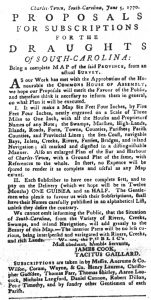
In the fall of 1773, James Cook, a surveyor, advertised a “COMPLEAT and CORRECT MAP of SOUTH-CAROLINA” to readers of the South-Carolina Gazette and Country Journal.  He underscored that he went to “great Expence in surveying” the colony, “informing himself of the District Lines, Sea-Coast, &c. with many other Particulars of general Utility.”  Furthermore, he made arrangements for “the Engraving and Colouring [to be] executed by the best Hands in London.”  The surveyor asserted that his map was “as useful a Piece of Geography as any extant.  According to William P. Cumming in British Maps of Colonial America, as quoted in the overview presented by David Rumsey Map Collection, Cook’s map was “the most detailed and accurate printed map of South Carolina, especially for the interior, yet to appear.”  You may examine a high-resolution image of Cook’s “Map of the PROVINCE of SOUTH CAROLINA” at the David Rumsey Map Collection.

Inset from James Cook, Map of the Province of South Carolina, engraved by Thomas Brown (London: 1773).  Courtesy David Ramsey Map Collection.

In his advertisement, Cook declared that map provided “a clear Idea, not only of this Province, but of the Catabaw Nation, Part of North-Carolina, and as far back as the Blue Mountains, … together with the established Dividing Line of the two Provinces.”  A small amount of territory denoted “CATABAW NATION” appeared in the northern region, but the depiction of “Catabaw Town” consisted of six squares, presumably representing houses.  The insets provided more detail of English settlements and outposts: “A PLAN of CHARLESTOWN,” “A PLAN of GEORGETOWN,” “A PLAN of CAMDEN,” “A PLAN OF BEAUFORT ON PORT ROYAL ISLAND,” and “A DRAUGHT of PORT ROYAL HARBOUR in SOUTH CAROLINA with the Marks for going in.”  Mapping the colony from the coast into the interior was an act of taking possession of the land (including, as the title of the map stated, “Roads, Marshes, Ferrys, Bridges, Swamps, Parishes Churches, Towns, Townships; COUNTY PARISH DISTRICT and PROVINCIAL LINES) and waterways (including Rivers, Creeks, Bays, Inletts, Islands [to facilitate] INLAND NAVIGATION”).  That simultaneously dispossessed indigenous inhabitants or, in the case of the Catawba, confined them to small districts.  One more inset depicted a scene with two well-dressed English gentlemen, either merchants or planters, conversing next to the cargo of a ship with several buildings visible on the other side of a harbor or river.  An enslaved African, shirtless in contrast to the finery of the gentlemen, carries a parcel on his back.  An indigenous man observes, sitting on the other side of a tree and an alligator, removed from the English settlement and the commerce undertaken by the English gentlemen and the enslaved African.  He holds a bow in one hand and an arrow in the other, representing, from the perspective of the producers and consumers of the map, the dangers that colonizers continued to face from the indigenous population.

Cook hoped that the map “will merit the Approbation of the Public” and sell many copies “at the low Price of TWO DOLLARS and a HALF.”  Whatever the sales may have been in the 1770s, only six copies survive, five in institutions in the United States and a sixth at the British Museum.  Perhaps so few survive in part because consumers did not purchase the maps solely to decorate homes or merchants’ offices but instead used them to traverse the land and waterways of the colony.

July 27

What was advertised in a colonial American newspaper 250 years ago today?

South-Carolina Gazette and Country Journal (July 27, 1773).

“ITS USES are so well known as to need no Recommendation.”

Zepheniah Kingsley marketed “BOWEN’s patent SAGO” and “BOWEN’s patent SOY” in advertisements in the South-Carolina Gazette and the South-Carolina Gazette and Country Journal in July 1773.  In an advertisement placed in the Georgia Gazette five years earlier, Samuel Bowen explained that just one pound of his sago powder “will make a mess of wholesome nourishing food for 20 men.  It is of a light and nourishing substance, proper for fluxes and other disorders in the bowels, also in consumptive and ma[n]y other cases.”  At the time Kingsley placed his advertisement, he declared that the uses of sago powder “are so well known as to need no Recommendation.”  All the same, he trumpeted that the product was “So much esteemed in the ROYAL NAVY, and in the AFRICAN TRADE, as an ANTISCORBUTIC and the only CURE for the FLUX.”  In other words, captains fed it to sailors and captive Africans to prevent scurvy and treat dysentery.

Kingsley also noted that “the ROYAL SOCIETY, the ROYAL COLLEGE of PHYSICIANS, and the SOCIETY for the Encouragement of ARTS, MAUFACTURES and COMMERCE” all “approved” of sago powder, echoing endorsements that Bowen previously listed in his advertisement.  Furthermore, Kingsley made reference to testimonials from the captain and scientists aboard the Endeavour following that vessel’s famous “Voyage round the World” from 1768 to 1771, stating that sago powder’s “good Effects are likewise vouched by Captain COOKE, … Mr. BANKES and Dr. SOLANDER, … as appears by their Report since their Return.”  English botanist Joseph Banks and Swedish naturalist Daniel Solander were among the representatives of the Royal Society on that voyage.  To underscore the acclaim earned by “BOWEN’s patent SAGO,” the royal coat of arms of the United Kingdom adorned Kingsley’s advertisement in the South-Carolina Gazette and Country Journal.  Kingsley apparently did not consider it necessary to provide more details about the uses and effectiveness of Bowen’s sago powder.  The various endorsements of the product spoke for themselves.

July 31

What was advertised in a colonial American newspaper 250 years ago today?

Jul 31 - 7:31:1770 South-Carolina Gazette and Country Journal
South-Carolina Gazette and Country Journal (July 31, 1770).

“The Gentlemen who please to favour us with their Subscriptions, shall have their Names carefully published in an alphabetical List.”

Like many books, maps were often published by subscription in the eighteenth-century.  Mapmakers published subscription notices to incite demand as well as gauge interest in their projects.  Doing so also allowed them to avoid some of the risk inherent in the enterprise.  Upon attracting a sufficient number of subscribers, they moved forward with confidence in the financial viability of the project.  On occasions that they lacked subscribers, they knew that it was not worth the time and resources required to publish a book or print a map.  Subscription lists also gave them a sense of how many copies to produce in order to avoid producing a large quantity that did not sell and counted against the financial success of the venture.

In the summer of 1770, James Cook and Tacitus Gaillard published “PROPOSALS FOR SUBSCRIPTIONS FOR THE DRAUGHTS Of SOUTH-CAROLOINA,” their subscription notice for a map of the colony.  They presented this undertaking as a community endeavor, first noting that their work “has met with the Approbation of the Honourable the COMMONS HOUSE OF ASSEMBLY” and stating that they hoped their “Proposals will merit the Favour of the Public.”  Subscribers did not need to contact Cook and Gaillard directly.  Instead, they designated local agents who gathered names on their behalf, listing them at the conclusion of the advertisement.  Those agents included several prominent merchants and planters as well as Peter Timothy, the printer of the South-Carolina Gazette.  In addition, “sundry other Gentlemen of each Parish” also accepted subscriptions and reported them to Cook and Gaillard.  The mapmakers gave the impression that their project already had the support – and the financial backing through subscriptions of their own – of some of the most prominent men in the colony.

Cook and Gaillard offered subscribers an opportunity to join the ranks of those prominent men … and to enjoy public recognition that they had done so.  “The Gentlemen who please to favour us with their Subscriptions,” the mapmakers promised, “shall have their Names carefully published in an alphabetical List, unless they desire the contrary.”  Books and maps published by subscription often featured such lists that acknowledged the benefactors that made the projects possible.  Publishing subscription lists drew together in one place all the members of the community that supported these projects, giving subscribers the chance to associate with others in a manner that remained visible to the public long after they subscribed, paid for, and collected their books and maps.  These lists became lasting records of which colonists supported the publication of books and maps.  Cook and Gaillard’s marketing strategy suggested that securing a spot on their subscription list was nearly as alluring as acquiring a copy of their beautifully rendered map.  Subscribers purchased prestige along with the map.