What was advertised in a colonial American newspaper 250 years ago today?
“An accurate map of Baltimore and Harford counties.”
Authors, booksellers, and printers often published books and magazines by subscription in the eighteenth century … or at least attempted to do so. Before taking publications to press, they distributed subscription proposals to encourage interest and assess demand. Subscribers reserved copies in advance, sometimes paying deposits. If the publishers determined that the number of subscribers would make books or magazines viable enterprises, they moved forward with the proposed works. If subscriptions did not generate sufficient revenue, publishers abandoned projects.
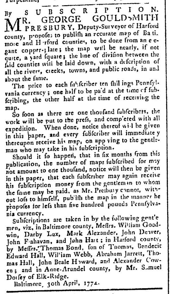
Artists and engravers also used subscriptions for publishing prints, as did surveyors for maps. George Gouldsmith Presbury, “Deputy-Surveyor of Harford county” in Maryland, published subscription proposals for “an accurate map of Baltimore and Harford counties” in the Maryland Journal, Baltimore’s first newspaper, in 1774. That the surveyor envisioned a market for this map testified to the growing significance of Baltimore on the eve of the American Revolution. The map “will be nearly, if not quite, a yard square” and feature “a description of all the rivers, creeks, town, and public roads.” Presbury needed commitments from “one thousand subscribers” before “the work will be put to press.” To aid in the endeavor, more than a dozen local agents in Baltimore, Harford, and Anne Arundel Counties accepted subscriptions and deposits. Upon publication, Presbury would advertise in the Maryland Journal once again, calling on subscribers to collect their maps form the local agents who accepted their subscriptions.
Presbury also allowed for the possibility that the market would not yet support this project. He allowed for six months for subscribers to reserve their copies, advising that he “cannot, without loss to himself, publish the map in the manner he proposes” if he did not raise enough funds. If necessary, “notice will then be given in this paper” that the proposal had not succeeded and “each subscriber may again receive his subscription money” from the local agent that received it. Apparently, that was the case, though Presbury did publish A New and Accurate Map of Baltimore-Town six years later. Presbury and other prospective publishers used subscription proposals to take risks in the marketplace for books, magazines, prints, and maps, but only to an extent, while shielding themselves from losses.
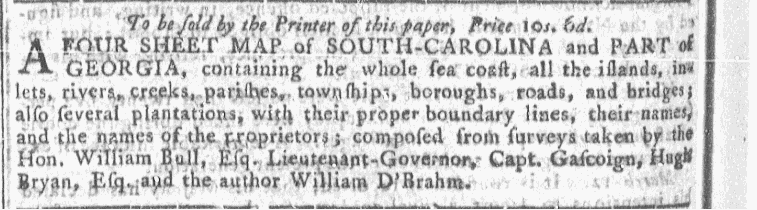
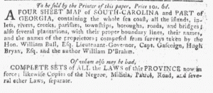
 “A FOUR SHEET MAP of SOUTH-CAROLINA and PART of GEORGIA”