January 1

What was advertised in a revolutionary American newspaper 250 years ago today?

Dunlap’s Pennsylvania Packet (January 1, 1776).

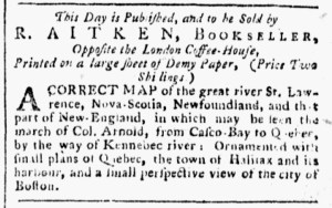
“A CORRECT MAP … in which may be seen the march of Col. Arnold.”

On January 1, 1776, Robert Aitken, a printer and bookseller, advertised that he had for sale a “CORRECT MAP of the great river St. Lawrence, Nova-Scotia, Newfoundland, and that part of New-England, in which may be seen the march of Co. Arnold, from Casco-Bay to Quebec, by wat of Kennebec river.”  The map featured insets depicting the “plains of Quebec, the town of Halifax and its harbour, and a small perspective view of the city of Boston.”  Like several other maps and prints advertised in the months following the outbreak of hostilities at Lexington and Concord in April 1775, this map supplemented the news that colonizers read in the newspapers and heard when they discussed current events.

This “CORRECT MAP” aided in understanding the dual-pronged American invasion of Quebec that commenced near the end of August.  General Richard Montgomery and 1200 soldiers headed from Fort Ticonderoga, New York, recently captured from the British, toward Montreal.  That city surrendered to Montogomery on November 13.  Meanwhile, Colonel Benedict Arnold and 1100 soldiers sailed from Newburyport, Massachusetts, to the mouth of the Kennebec River on September 15.  They made a harrowing trek through the wilderness of northern New England, losing nearly half their number to death or desertion, before reaching Quebec City on November 14.  Arnold and his soldiers besieged the city, eventually supported by Montgomery and reinforcements on December 2.  The enlistments for many of the American soldiers ended on December 31, prompting Montgomery and Arnold to attack the city during a snowstorm.  The weather did not work to their advantage.  Montgomery was killed, Arnold wounded, and four hundred American soldiers captured.  Arnold assumed command and continued the siege, realizing that British reinforcements would arrive when the St. Lawrence River became navigable again in the spring.  When General John Burgoyne arrived in May, Arnold led a retreat to upstate New York.  Ultimately, the American invasion of Canada failed.

When they saw Aitken’s advertisement for a “CORRECT MAP … in which may be seen the march of Col. Arnold” in the January 1 edition of Dunlap’s Pennsylvania Packet, they had no way of knowing about the failed attack that occurred the previous day.  Supporters of the American cause still hoped that Montgomery and Arnold would capture Quebec City, dealing a significant blow to the British.  Along with newspaper coverage, the map chronicled what readers knew about the invasion of Canada, including the hardships endured by Arnold and the soldiers under his command who endured so many hardships in the wilderness of northern New England.

**********

For more information about the Quebec Campaign, see Nathan Wuertenberg’s more comprehensive overview.

December 13

What was advertised in a revolutionary American newspaper 250 years ago today?

Connecticut Journal (December 13, 1775).

“FOUR different Views of the BATTLES of LEXINGTON, [and] CONCORD.”

The marketing of memorabilia that commemorated events associated with the American Revolution began before the Second Continental Congress declared independence.  Shortly after the Boston Massacre, for instance, Paul Revere, Henry Pelham, and others produced and advertised images depicting the “BLOODY MASSACRE perpetrated in King-Street.”  Revere also marketed a “Copper-Plate PRINT, containing a View of Part of the Town of Boston in New-England, and British Ships of War landing their Troops in the Year 1768.”  As the imperial crisis intensified, Charles Reak and Samuel Okey advertised a print depicting “that truly staunch Patriot, the Hon. SAMUEL ADAMS, of Boston.”  The production of commemorative items accelerated following the battles at Lexington and Concord in April 1775 and the Battle of Bunker Hill in June 1775.

In December 1775, James Lockwood advertised “FOUR different Views of the BATTLES of LEXINGTON, CONCORD, &c. on the 19th of April, 1775.”  He provided a short description of each: “The Battle at Lexington,” “A View of the Town of Concord with the Ministerial Troops destroying the Stores,” “The Battle at the North Bridge in Concord,” and “The South Part of Lexington where the first Detachment were join’d by Lord Percy.”  Lockwood promoted both the quality and accuracy of the prints, noting that the “Four Plates are neatly engraved on Copper, from original Paintings taken on the Spot.”  He almost certainly stocked and sold a series of prints engraved by Amos Doolittle based on paintings by Ralph Earl.  Although Lockwood may have sold the prints separately on request, he promoted them as a package, charging six shillings for as set of “the plain ones” or eight shillings for “coloured” prints.  This collection of prints supplemented news coverage of the battles, helping educate colonizers about recent events, yet many consumers may have desired them as symbols of their patriotism and support of the American cause to display in their homes and offices.  During the first year of the Revolutionary War, the marketing of images that celebrated Americans who defended their towns and their liberties likely encouraged some colonizers to imagine declaring independence rather than merely seeking a redress of grievances.

November 30

What was advertised in a revolutionary American newspaper 250 years ago today?

New-York Journal (November 30, 1775).

“A neat Mezzotinto Print of the Hon. JOHN HANCOCK, Esq.”

Richard Sause, a cutler in New York, became a purveyor of patriotic memorabilia during the Revolutionary War.  In October 1775, he advertised “ROMAN’s MAP OF BOSTON,” billing it as “one of the most correct that has ever been published.”  He described the cartographer, Bernard Romans, as “the most skilful Draughtsman in all America,” noting that he earned credibility because he “was on the spot at the engagements of Lexington and Bunker’s-Hill.”  Nicholas Brooks, a shopkeeper who specialized in prints, and Romans collaborated on the project in Philadelphia.  Sause acted as a local agent for marketing and distributing the map in New York.

That was not the only item commemorating current events that Sause advertised and sold.  At the end of November 1775, he took to the pages of the New-York Journal once again, informing the public that he sold a “neat Mezzotinto Print of the Hon. JOHN HANCOCK, Esq.”  The print depicting the merchant from Boston who served as president of the Second Continental Congress was another one of Brooks’s projects.  In addition, Sause also stocked “a view of the BATTLE at Charlestown” and “an accurate Map of the Present Seat of Civil War, taken by an able Draftsman.”  Sause seemingly worked closely with Brooks in acquiring the various prints and marketing them to patriots in New York, perhaps even providing him with advertising copy to adapt for his own notices.  The prints that Sause offered for sale appeared in the same order in his advertisement in the New-York Journal that they did in Brooks’s advertisement in Pennsylvania Journal.  Brooks may have sent a clipping along with the prints that he dispatched to the cutler in New York.

Although Sause had established himself as a cutler who also sold hardware and jewelry in a series of advertisements in New York’s newspapers, his activities in the marketplace in 1775 emphasized his commitment to the American cause.  Before he began selling prints, he promoted “SMALL SWORDS” to gentlemen who anticipated participating in the defense of their liberties and their city.  Even though he continued to advertise an “assortment of Jewellery, Cutlery, Hardware, and Haberdashery,” he made items related to the conflict with Parliament and British troops quartered in the colonies the focal point of his advertisements.

November 27

What was advertised in a revolutionary American newspaper 250 years ago today?

Norwich Packet (November 27, 1775).

“Illustrated with a beautiful PLAN OF BOSTON, AND THE PROVINCIAL CAMP.”

When Alexander Robertson, James Robertson, and John Trumbull, printers of the Norwich Packet, advertised Bickerstaff’s New-England Almanack, For the Year of Our Lord, 1776, they promoted the “beautiful PLAN OF BOSTON, AND THE PROVINCIAL CAMP” that accompanied the handy reference volume.  Like many other almanacs for 1776 (published in the final months of 1775), this one featured items related to the events that had transpired since the battles at Lexington and Concord on April 19.  In addition to the map of Boston, it also contained the “Method of making Gun-Powder, which at this Juncture may be carried into Execution in a small Way, by almost every Farmer in his own Habitation.”  In a resolution passed in late June, the Second Continental Congress encouraged colonizers to contribute to the American cause by manufacturing gunpowder and saltpeter in small batches.

As a marketing strategy, the printers highlighted the “PLAN OF BOSTON, AND THE PROVINCIAL CAMP” that depicted the ongoing siege of Boston by the American army under the command of George Washington.  Along with the headline in the advertisement, they listed the elements of the “very neat Plan of the Town of Boston, shewing at one View, the Provincial Camp, Boston Neck, Fortifications, Commons, Battery, Magazine, … Liberty Tree, … Bunker’s Hill, … Provincial Lines, … Roxbury Hill Lines, Ministerial Army’s Lines,” and many other significant sites in the area.  The Robertsons and Trumbull declared that this map was “Equally accurate with that sold in the southern Colonies at one Spanish Dollar.”  Consumers did indeed have other options for purchasing similar maps, either separately or inserted in the Pennsylvania Magazine or inserted in another almanac.  Indeed, the map that accompanied Bickerstaff’s New-England Almanack looked almost identical to the one that illustrated “HUTCHIN’s Improv’d,” printed and sold by Hugh Gaine in New York.  Maps of Boston proliferated in 1775 as printers sought to generate revenues while keeping the public informed about current events and consumers sought materials beyond news reports to help them envision and understand what occurred in Massachusetts as resistance became revolution.

“Plan of Boston,” in Bickerstaff’s New-England Almanack, for the Year of Our Lord, 1776 (Norwich, Connecticut: Robertsons and Trumbull, 1775). Courtesy Boston Rare Maps.

November 1

What was advertised in a revolutionary American newspaper 250 years ago today?

Pennsylvania Journal (November 1, 1775).

“A NEAT Mezzotinto print of the Hon. JOHN HANCOCK.”

“A large and exact VIEW of the late BATTLE at CHARLESTOWN.”

“An accurate map of the present seat of CIVIL WAR.”

Nicholas Brooks produced and marketed items that commemorated the American Revolution before the colonies declared independence.  In an advertisement in the November 1, 1775, edition of the Pennsylvania Journal, for instance, he packaged together three prints previously advertised separately, each of them related to imperial crisis that had boiled over into a war.  For this notice, Brooks presented them as a collection of prints for consumers who wished to demonstrate their support for the American cause by purchasing and displaying one or more of them.

Brooks announced that a “NEAT Mezzotinto print of the Hon JOHN HANCOCK, Esquire, President of the CONTINENTAL CONGRESS,” that had previously been proposed in other advertisements had been published and was now for sale at his shop on Second Street in Philadelphia.  The subscribers who had reserved copies in advance could pick up their framed copies or arrange for delivery.  Others who had not placed advanced orders could acquire the print for three shillings and nine pence or pay two extra shillings for one “elegantly coloured.”

“Likewise, may be had at the above place,” Brooks reported, “a large and exact VIEW of the late BATTLE at CHARLESTOWN,” depicting what has become known as the Battle of Bunker Hill.  This print competed with an imitation bearing a similar title, “a neat and correct VIEW of the late BATTLE at CHARLESTOWN,” that Robert Aitken inserted in the Pennsylvania Magazine and sold separately.  Brooks, who had long experience selling framed prints, offered choices for his “exact VIEW.”  Customers could opt for an “elegantly coloured” version for seven shillings and six pence” or have it “put in a double carved and gilt frame, with glass 20 by 16 inches,” for eighteen shillings and six pence.  The eleven shillings for the frame, half again the cost of the print, indicated that Brooks anticipated that customers would display the “exact VIEW” proudly in their homes or offices.

He also promoted “an accurate map of the present seat of CIVIL WAR, taken by an able Draughtsman,” Bernard Romans, “who was on the spot of the late engagement.”  Brooks revised copy from earlier advertisements: “The draught was taken by the most skillful draughtsman in all America, and who was on the spot at the engagements of Lexington and Bunker’s Hill.”  The map showed a portion of New England that included Boston, Salem, Providence, and Worcester.   This print, he declared, was a “new impression, with useful additions,” though he did not specify how it differed from the one he previously marketed and sold.  As with the others, customers had a choice of a plain version for five shillings or a “coloured” one for six shillings and six pence.

Brooks added one more item, “a humorous and instructive print, entitled the COMET of 1774, done by a Gentleman in New-York.”  Did this print offer some sort of satirical commentary on current events?  Or was it unrelated to the prints of Hancock, the Battle of Bunker Hill, and the “CIVIL WAR” in New England?  Whatever the additional print depicted, Brooks made the prints that commemorated the American Revolution the focus of his advertisement, gathering together three items previously promoted individually.  In so doing, he not only offered each print to customers as separate purchases but also suggested that they could consider them part of a collection.  Consumers who really wanted to demonstrate their patriotism could easily acquire all three at his shop.

October 18

What was advertised in a revolutionary American newspaper 250 years ago today?

Pennsylvania Journal (October 18, 1775).

“An Elegy to the memory of the American Volunteers who fell … April 19, 1775.”

During the era of the American Revolution, advertisements for almanacs frequently appeared in newspapers from New England to Georgia each fall.  Such was the case in the Pennsylvania Journal in 1775.  James Adams, a printer in Delaware, inserted a notice that announced that he “JUST PUBLISHED … The WILMINGTON and PENNSYLVANIA ALMANACKS, For the year of our LORD, 1776.”

Adams followed a familiar format for advertising almanacs.  He indicated that both editions included “the usual astronomical calculations” that readers would find in any almanac as well as a variety of other enticing contents.  The Pennsylvania edition included “Pithy Sayings” for entertainment and “Tables of Interest at six and seven per cent” for reference as well as the “Continuation of William Penn’s Advice to his Children” and the “Conclusion of Wisdom’s Call to the young of both sexes.”  Adams published a portion of those pieces in the almanac for the previous year, anticipating that readers would purchase the subsequent edition for access to the essays in their entirety.  The almanac for 1776 also suggested “Substitutes for Tea,” certainly timely considering that the Continental Association remained in effect. Colonizers sought alternatives while they boycotted imported tea.

Current events played an even more prominent role in the Wilmington Almanack.  It featured an “Elegy to the memory of the American Volunteers, who fell in the engagement between the Massachusetts-Bay Militia and the British Troops, April 19, 1775.”  Six months after the battles at Lexington and Concord, Adams memorialized the minutemen who had died for the American cause during the first battles of the Revolutionary War.  In addition, the almanac featured “The Irishman’s Epistle to the Officers and troops at Boston,” “Liberty-Tree,” and “A droll Dialogue between a fisherman of Poole, in England, and a countryman, relative to the trade of America, and proposed victory over the Americans.”  Adams did not elaborate on those items, perhaps intentionally.  Presenting the titles of the pieces without further elaboration was standard practice in advertisements for almanacs, but in this case the printer may have intended to stoke curiosity that would lead to more sales.  For both almanacs, a concern for current events and a burst of patriotism influenced the contents and their marketing.

October 16

What was advertised in a revolutionary American newspaper 250 years ago today?

New-York Journal (October 16, 1775).

“THIS Map of Boston, &c. is one of the most correct that has ever been published.”

Richard Sause, a cutler in New York, became a local agent in that city when Nicholas Brooks and Bernard Romans collaborated on a map of Boston.  Brooks, a shopkeeper in Philadelphia, described himself as “the printer of said Maps” in newspaper advertisements, though he likely meant that he was the publisher who collaborated with Romans, a noted cartographer.  Sause had not been among the original list of local agents in an advertisement that appeared in Rivington’s New-York Gazetteer in August 1775, nor had he been on the list on a broadside subscription proposal that circulated in the summer and fall.  When Brooks and Romans launched a second project, “An Exact VIEW of the late BATTLE at CHARLESTOWN,” the subscription proposal in the Pennsylvania Ledger included “Mr. Richard Sause in New-York” among the local agents.  Brooks and Romans apparently supplied him with copies of the map as well as the print depicting what is now known as the Battle of Bunker Hill.

Sause, a frequent advertiser, was already familiar to consumers in New York.  A woodcut depicting various kinds of cutlery available at his “Jewlery, Hardware, and Cutlery Store” often adorned his advertisements in newspapers printed in that city.  In the summer and fall of 1775, he emphasized “SMALL SWORDS” in his advertisements.  Following the outbreak of hostilities at Lexington and Concord in April, residents of New York and other towns did not know what to expect.  Many prepared to defend their liberties should the British turn their attention to them.  Sause made sure that Patriots in New York knew that he could supply them with various kinds of small swords.  He even made a pitch for those items at the end of his advertisement for Romans’s map of Boston: “Swords and Cutteaux de Chase [a short sword], with a variety of Jewellery, Hardware and Cutlery, to be sold at the above Store.”

Yet the “MAP OF BOSTON” was the main attraction in that advertisement.  In addition to the headline in capital letters, Sause’s notice billed the map as “one of the most correct that has ever been published.”  To help make sales, he emphasized that the “draught [draft] was taken by the most skilful Draughtsman in all America.”  Buyers could depend on its accuracy because Romans “was on the spot at the engagements of Lexington and Bunker’s-Hill.”  Current events certainly played a role in Sause expanding his business to incorporate a new revenue stream, yet marketing and selling both Brooks and Romans’s map of Boston and prints depicting the Battle of Bunker Hill also gave him an opportunity to participate in politics via the marketplace.

September 25

What was advertised in a revolutionary American newspaper 250 years ago today?

New-York Gazette and Weekly Mercury (September 25, 1775).

“Illustrated with a beautiful Plan of Boston, and the Provincial Camp.”

When fall arrived, it was time to market almanacs for the coming year.  It was an annual ritual in American newspapers from New England to Georgia.  Hugh Gaine, the printer of the New-York Gazette and Weekly Mercury, began advertising “HUTCHIN’s Improv’d: BEING AN ALMANACK … For the Year of our LORD 1776” on September 18, 1775, and then inserted his extensive notice in subsequent issues.  The almanac’s contents included the usual astronomical data, such as “Length of Days and Nights” as well as a schedule of the courts, a description of roads to other cities and towns, and “useful Tables, chronological Observations and entertaining Remarks.”  Gaine enumerated thirty-one of those items, such as a “Very comical, humorous, and entertaining Adventure of a young LADY that used to walk in her sleep,” an essay on the “evil Consequences of Sloth and Idleness,” and a “Method for destroying Caterpillars on Trees.”

If all of that was not enough to entice customers, Gaine made sure that they knew that the almanac was “Illustrated with a beautiful Plan of Boston, and the Provincial Camp.”  That proclamation led the advertisement, appearing immediately above the title of the almanac.  Gaine then devoted the greatest amount of space to describing the map: “13. A very neat Plan of the Town of Boston, shewing at one View, the Provincial Camp, Boston Neck, Fortification, Commons, Battery, Magazines, Charlestown Ferry, Mill Pond, Fort Hill, Corps Hill, Liberty Tree, Windmill Point, South Battery, Long Wharf, Island Wharf, Hancock’s [Wharf], Charlestown, Bunker’s Hill, Winter Hill, Cobble Hill, Forts, Prospect Hill, Provincial Lines, Lower Fort, Upper [Fort], Main Guard, Cambridge College, Charles River, Pierpont’s Mill, Fascine Battery, Roxbury Hill Lines, General Gage’s Lines, Dorchester Hill and Point, and Mystick River.”  As the siege of Boston continued, Daine realized that colonizers in Boston would be interested in supplementing what they read in newspapers and heard from others with a map that would help them envision and better understand recent events.

What was the source for the map?  According to the catalog description for the almanac by PBA Galleries, Auctioneers and Appraisers, the map, “titled a ‘Plan of Boston,’ details Boston’s Shawmut Peninsula and with a smaller inset of the greater Boston area.  Both maps appear to be based on the ‘New and Correct Plan of the Town of Boston and Provincial Camp,’ which appeared in the Pennsylvania Magazine for July, 1775.”  The image that Aitken marketed to spur magazine sales found its way into another periodical publication.  Another printer used it to generate demand for an item produced on his press.

Gaine also listed “11. The whole Process of making SALT PETRE, recommended by the Hon. The Continental Congress, for the making of which there is a Bounty now given both in this and the neighbouring Provinces” and “12. The Method of making Gun-Powder, which at this Juncture may be carried into Execution in a small Way, by almost every Framer in his own Habitation.”  The auction catalog further clarifies that the almanac contains “the Resolution of Congress, July 28, 1775 on the necessity of making gunpowder in the colonies, signed in print by John Hancock, with a recipe for gunpowder on the reverse of the map.”  More than ever, current events played a part in compiling the contents and then marketing almanacs.

“Plan of Boston,” in Hutchins Improved: Being an Almanack and Ephemeris … For the Year of Our Lord 1776 (New York: Hugh Gaine, 1775). Courtesy PBA Galleries, Auctioneers and Appraisers.

August 21

What was advertised in a revolutionary American newspaper 250 years ago today?

New-York Gazette and Weekly Mercury (August 21, 1775).

“To the last Number for July, is affix’d a new and correct Plan of the TOWN of BOSTON, and PROVINCIAL CAMP.”

In the summer of 1775, Samuel Loudon, a bookseller in New York, stocked books printed by Robert Aitken in Philadelphia.  He advertised Military Instructions for Officers Detached in the Field, “DEDICATED TO His Excellency General Washington,” and The Art of Speaking in the August 21, 1775, edition of the New-York Gazette and Weekly Mercury.  He also noted that he stocked an assortment of paper and a “Variety of Books” that he “sold at the very lowest Price.”

Loudon concluded his advertisement by promoting another of Aitken’s projects.  The bookseller advised the public that he collected subscriptions “for that very useful and interesting “PENNSYLVANIA MAGAZINE, published by Mr. AITKEN.”  The Pennsylvania Magazine, or, American Monthly Museum commenced publication with its January 1775 issue, briefly overlapping with the Royal American Magazine.  Upon the demise of the latter, it became the only magazine published in the colonies.

To incite interest, Loudon noted that “the last Number for July” featured a “new and correct Plan of the TOWN of BOSTON, and PROVINCIAL CAMP.”  According to the Norman B. Leventhal Map and Education Center at the Boston Public Library, this map “was the earliest printed depiction of Boston after the battle of Bunker Hill, June 17, 1775.”  It includes an inset that “shows the location of the location of the battle, as well as provincial (American) lines in the communities surrounding Boston.”  This demonstrated “the commanding position enjoyed by the Continental Army.”

Getting a free map of Boston following the Battle of Bunker Hill was certainly an incentive to subscribe to the Pennsylvania Magazine!  But was it the first map of Boston created after that battle?  Perhaps, but it might better be described as one of the first depictions of Boston after the Battle of Bunker Hill.  A note in the Leventhal Center’s online catalog states, “This date is inferred,” likely because the map was “Engrav’d for the Pennsylva. Magazine” for July 1775.  Yet the assertion that it was the earliest printed depiction of Boston after the Battle of Bunker Hill may rely on an assumption that colonial printers published magazines at the beginning of the month when they instead issued monthly issues at the end of the month or early in the following month.  Thus, Aitken distributed the July 1775 issue of the Pennsylvania Magazine at the same time that he, Nicholas Brooks, and others advertised Bernard Romans’s map of Boston, a map that also featured an inset showing the “Provincial Lines” during the siege of the city and the site of the Battle of Bunker Hill.  Aitken may have consulted with Romans when preparing a map to accompany the magazine.  For prospective subscribers, it may not have mattered whether they acquired the first map of Boston published after the Battle of Bunker Hill, only that they had access to the map … and at a bargain price since it came as a premium with their subscription to the Pennsylvania Magazine rather than purchasing Romans’s map separately.

“A New and Correct Plan of the Town of Boston, and Provincial Camp” (1775). Courtesy Norman B. Leventhal Map and Education Center at the Boston Public Library.

August 19

What was advertised in a revolutionary American newspaper 250 years ago today?

Pennsylvania Ledger (August 19, 1775).

“Map of Boston … the engagements of Lexington and Bunker’s Hill.”

More advertisements for “MR. ROMANS’s MAP OF BOSTON” appeared in the August 19, 1774, edition of the Pennsylvania Ledger.  Bernard Romans, the cartographer who created a “MAP, FROM BOSTON TO WORCESTER, PROVIDENCE AND SALEM. Shewing the SEAT of the present unhappy CIVIL WAR in NORTH-AMERICA,” and Nicholas Brooks, the publisher, previously promoted the project with a broadside subscription proposal that began circulating in the middle of July and scattered references to the map at the end of advertisements in the Pennsylvania Ledger.  Two weeks earlier, for instance, Brooks ran an advertisement that featured an extensive list of merchandise available at his shop and added a nota bene of a single line: “Romans’s map of the seat of war near Boston, &c.”  Robert Aitken mentioned the map in a slightly longer nota bene when he advertised Military Instructions for Officers Detached in the Field.  An advertisement in Rivington’s New-York Gazetteer replicated the copy from the broadside.

Once the map was “completely finished, and ready to be delivered to the SUBSCRIBERS,” as William Bradford and Thomas Bradford put it in their advertisement, or “just Printed, Published, and To be Sold,” as Brooks proclaimed in his own notice, it received greater attention in newspaper notices.  Although many similar projects utilized subscription proposals in newspapers to generate demand attract orders in advance of publication, Romans and Brooks relied on their broadside subscription proposal during their first round of marketing and later added newspaper advertisements once the map was available for sale.

Just four months after the battles at Lexington and Concord, a remarkably short interval for such an endeavor, Brooks advertised copies of Romans’s map of Boston for sale at his “Dry Goods, Picture, and Jewellery SHOP” in Philadelphia.  He touted the quality of the map, declaring it “one of the most correct that has ever been published” and emphasiziong that the “draught was taken by the most skillful draughtsman in all America.”  As if that was not enough to sell it, Romans “was on the spot at the engagements of Lexington and Bunker’s Hill.”  Brooks marketed an eyewitness account of those important battles.  Furthermore, he asserted that consumers had a patriotic duty to examine the map, which they could do by purchasing it.  “Every well-wisher to this country,” Brooks trumpeted, “cannot but delight in seeing a plan of the ground on which our brave American Army conquered the British Ministerial Forces.”  Commemoration and commodification of the American Revolution occurred before the Continental Congress declared independence.